In Abra village near Saida in southern Lebanon, a lack of coordination in urban planning meant that no sooner had a new street been laid, that it would be dug up again to make way for trenches or sewage pipes. Alongside the mass disruption caused to residents and businesses, the ad hoc approach was clearly wasting limited resources. The output from aging sewer networks contaminated soil and ground water and out-of-date maps were all that was available to those seeking to make renovations.
ACTED and two partner organizations thus began work to boost the capacity of civil society and local government to bring up to date the areas planning approach.
Abra village is located in the district of Saida in southern Lebanon. Over the past 20 years, Abra has witnessed expansive growth, with its population reaching 15,000 inhabitants, through largely unplanned, random urbanization. The rapid and haphazard construction has led to a myriad of challenges which civil society and local government have struggled to address.
Prior to the intervention, urban development works in Abra under utilized available technologies and thus took place using outdated manual approaches. This negatively impacted the quality, accuracy and coverage of municipal services in light of a rapidly growing population.

Saida is the third largest city in Lebanon.
To encourage CSOs and local authorities to rise to the challenge of unplanned urban development, ACTED and its national partners SHEILD (Social, Humanitarian, Economical Intervention for Local Development) and Akkarouna reached out to 50 CSOs and 50 municipalities in Lebanon. ACTED provided training sessions targeted at the specific needs of each organization and the population which it serves as a means to respond to existing gaps.
In Abra municipality, ACTED undertook a detailed assessment to uncover gaps, weaknesses, and areas of potential capacity development before implementing a range of trainings that aimed to increase the municipality’s internal capacity. Geographical Information System (GIS) trainings played a central role in this initiative.
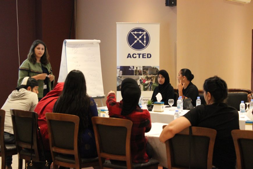
ACTED conducts a meeting with representatives of local CSOs
What is GIS?
Geographic information system (GIS) is a computer software that compiles all spatial information into a single simple system in order to help urban planners and decision-makers solve community problems by presenting geographical data in a format which is universally understood.
Seeing the importance of GIS technology, ACTED conducted trainings on how to use this software within the municipality of Abra in order to organize all available data relating to the physical built environment of the city and its surroundings (such as infrastructure, sewage and water networks, transportation, buildings, green spaces, and natural resources, among others), thus contributing to improved overall resource management and service delivery.
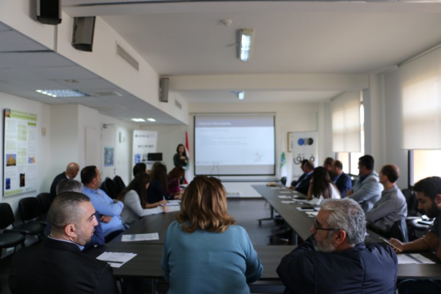
An ACTED GIS training underway
Eugenie, a full-time employee at the municipality, is responsible for the department of infrastructure and property management. Before her introduction to GIS, extensive and extremely time consuming manual work had to be done, as she had to assemble and hand-color hard copies of maps by hand.
Eugenie took part in trainings on how to use GIS which had a great positive impact: the training covered how to define limits, position and categorize any piece of land, and identify roads, electricity networks, transport infrastructure and water networks etc. GIS now saves Eugenie uncountable man-hours compared to her previous approach, thereby increasing her overall productivity and the quality of municipal services.
GIS has drastically reduced the time I need to complete mapping tasks by more than 90%, and the results are much more accurate and professional!
Promoting a Better Community Environment
In the case of Abra, GIS made Eugenie’s job much easier, more efficient, more accurate and less time-consuming. More importantly, the software will allow municipalities to simulate where and how buildings and other major infrastructure should be constructed, especially when it comes to sewage networks and electricity. It will also allow the municipality to rapidly identify infrastructure failures and broken systems, and implement rehabilitation interventions accordingly.
By using GIS, I discovered how efficiently traditional tasks can be performed and how other tasks—previously impractical or impossible—can now be easily accomplished. Before, everything was very manual, we used to look into physical maps, now we only look at the computer to find this information
As a direct result of these trainings, residents are likely to see significant improvement in the quality of services offered by the municipality, especially on the level of urban planning.